New · from Terravision's satellite team
Check the ground before you buy or build
Leeds sits on old coal mines. Some streets are slowly sinking, and some plots flood. Pick any plot or scheme and get a plain-English ground report in minutes: old mine workings, ground movement seen from space, flood zones, slope and green belt, with a map you can open in Google Earth.
- Old shallow coal workings on or near the plot
- Is the ground sinking or rising? (radar satellites)
- Flood zone, slope and green belt
- Recent planning applications next door
- PDF report + Google Earth (KMZ) file
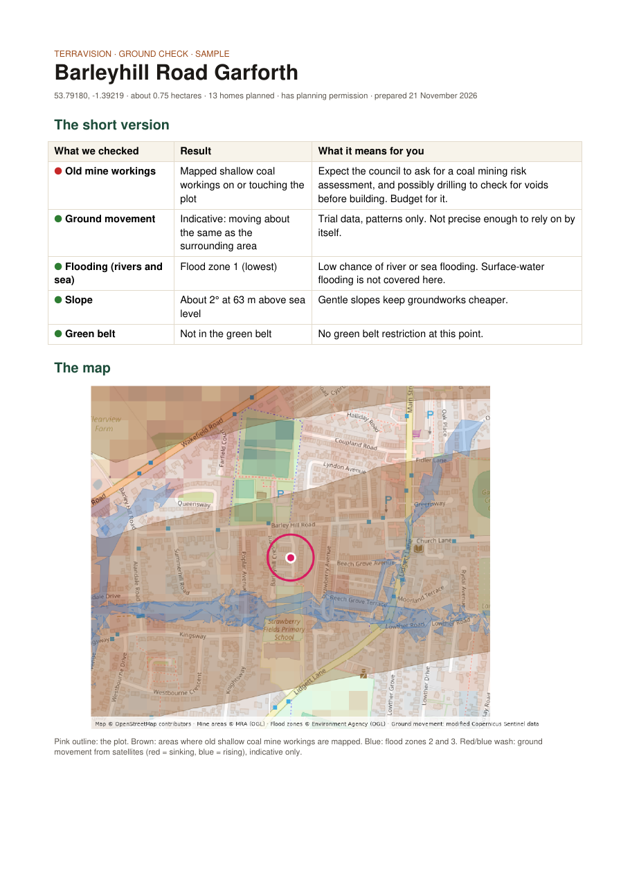 Sample: Barleyhill Road, Garforth
What you get
Quick check
£9
Instant PDF and Google Earth file for one plot or address.
- Old mine workings (Mining Remediation Authority maps)
- Flood zone and slope
- Green belt
- Planning applications within 500 m
Full ground pack
£29
Everything in the quick check, plus the ground-movement history.
- Ground-movement history year by year (official European satellite data)
- Movement compared with the streets around
- Mine entry and coal consultation area check
- Bigger 1 km map and layered KMZ
5-plot bundle
£99
Five full packs to use within 12 months. For builders, agents and investors comparing sites.
Buy the bundleSee a real sample
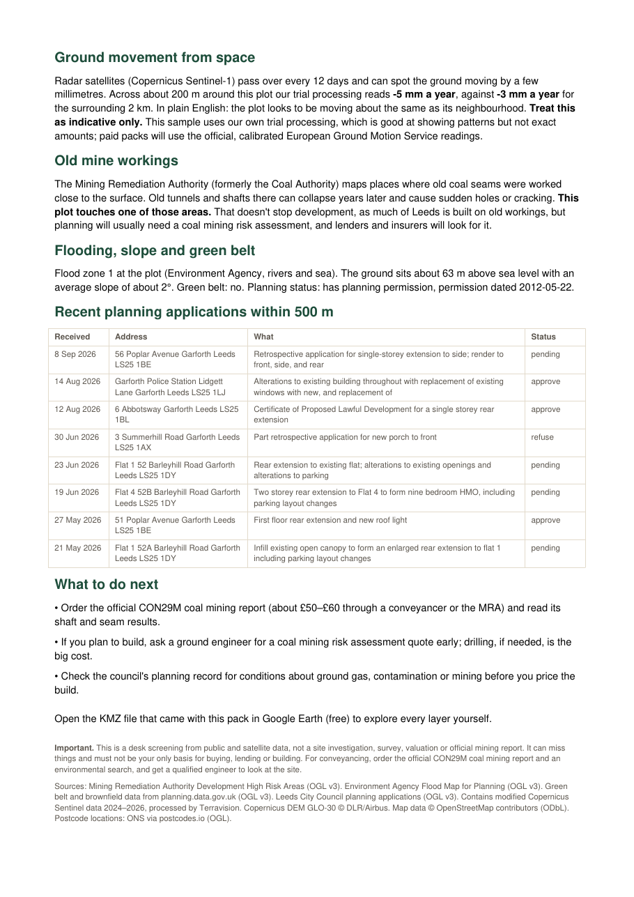
Open the sample PDF Download the sample KMZ
Good to know
Is this a survey?
No. It's a quick desk check from public maps and satellite data, so you know what to ask about. For a purchase you still need the official coal mining search (CON29M) and, for building, a ground engineer.
How do satellites see the ground move?
Radar satellites pass over every 12 days and measure the distance to the ground very precisely. Over months they can spot ground sinking or rising by a few millimetres a year.
How fast do I get it?
Plots and schemes on our map: straight away. Any other address in Leeds: usually within the hour.